Visitors at public facilities like zoos often face navigation difficulties, limited digital guidance, and minimal interactive learning experiences. Traditional tools such as static maps, signboards, and manual processes provide little engagement and do not offer real-time insights for administrators.
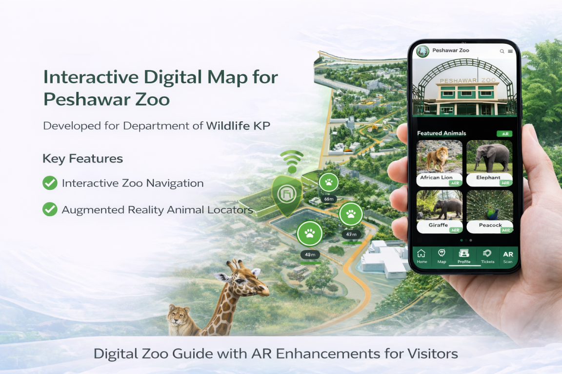
Students from Iqra National University, under the Civic Innovator Program, developed an Interactive Digital Map and AR-based mobile application for Peshawar Zoo. The cross-platform app combined 3D zoo maps, geolocation, and augmented reality to enhance visitor navigation and learning. Through AR overlays, users could point their camera toward animal enclosures to access digital content, while an animal directory, interactive maps, and user profiles enriched the visitor journey. The system also included online ticketing and QR code scanning for a smoother entry process.
Built using React Native and Firebase, the platform leveraged smartphones’ built-in cameras, GPS, and QR capabilities, requiring no additional hardware. A backend dashboard structure enabled data collection and analytics, allowing zoo management to better understand visitor patterns and plan services accordingly. The modular design supported phased development, including AR proof-of-concept features, ticketing integration, and future expansion.
The solution demonstrated strong potential to improve navigation, increase visitor engagement through interactive learning, and support data-informed management of public attractions.